
For 28 long years (1961-1989), the Berlin Wall divided the city into two parts – East and West Berlin. The wall was and remains in history a symbol of the Cold War and the division of Germany, which was unified in 1990. Wherever it passed, a historic route of 160 kilometers has now been laid – the Path along the Berlin Wall (Berliner Mauerweg) .
Memorial Complex
Construction of the Berlin Wall begins in August 1961
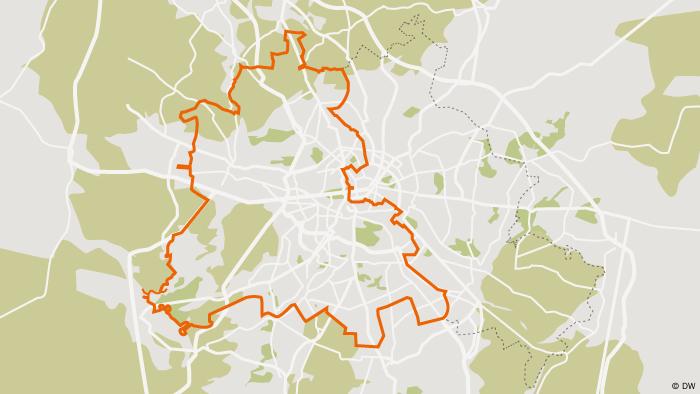
Trail along the Berlin Wall. route map

A preserved section of the Berlin Wall near Bernauer Strasse
You can start your biking or hiking tour anywhere and you don’t have to do the whole route at once. You can choose any location or walk this historic trail in stages. You can start in the center of the German capital, where the Berlin Wall memorial and documentation center are located on Bernauer Strasse.
where was the wall
“Berlin Wall 1961-1989”
Almost a six-kilometer segment is marked here by a double row of cobblestones, on which bronze plaques “Berlin Wall 1961-1989” (“Berliner Mauer 1961-1989”) are located at different distances from each other. Above the inscription was East Berlin, below – West. This helps to navigate the location.
Brandenburg Gate
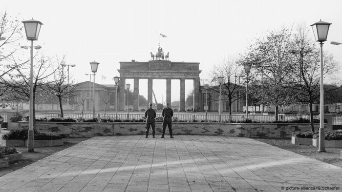
Border guards near the Brandenburg Gate shortly before the fall of the Berlin Wall in 1989
If you follow the memorial path on Bernauer Strasse towards the current government district of Mitte, the route will take you along the River Spree past the Reichstag to Parisian Platz and the Brandenburg Gate. During the time of the Berlin Wall, the gate was located between the two parts of the city, becoming a symbol of the division of Berlin and, after the fall, a symbol of German reunification.
Checkpoint Charlie
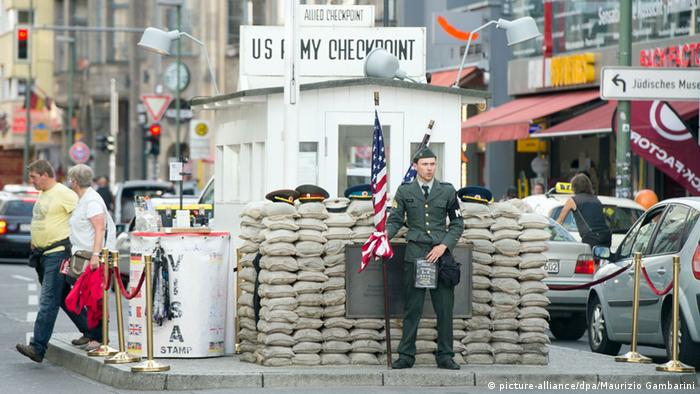
Former Checkpoint Charlie on Friedrichstrasse
It was possible to get from one part of the city to another during the existence of the Berlin Wall through eight checkpoints. The most famous of these is Checkpoint Charlie (Checkpoint Charlie) on Friedrichstrasse. Now here you can see the reconstruction from 2000. Due to the great popularity of this place, the atmosphere around it is more like a tourist “Disneyland”.
watchtowers
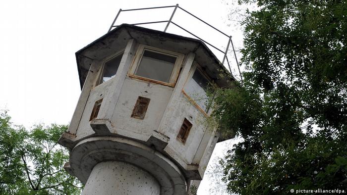
Old watchtower near Potsdamer Platz
More than three hundred watchtowers were erected along the Berlin Wall on the GDR side, in which soldiers were on duty 24 hours a day, ready to open fire to kill. Only three towers were left standing. They are under protection as historical monuments. One of them, built in concrete in 1966, is located near Potsdamer Platz and is open to the public.
east side gallery
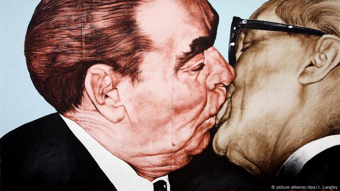
“Brotherly kiss” or “Lord! Help me to survive among this mortal love” – graffiti by Dmitry Vrubel depicting the kiss of Leonid Brezhnev and Erich Honecker
The longest surviving section of the Berlin Wall is located in the district of Friedrichshain – the famous East Side Gallery. After the opening of the border, these slabs were painted by artists, becoming a historic monument and a permanent open-air gallery. The most famous graffiti here is Dmitry Vrubel’s work “Brotherly Kiss”.
east side gallery
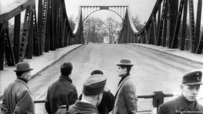
Glienik Bridge on the day of the exchange of American pilot Gary Powers and Soviet intelligence officer Rudolf Abel in 1962
Most of the trail – 110 kilometers – runs along the city’s outer border, which ran between West Berlin and Brandenburg. A special attraction here is the Glienicki Bridge over the Havel in the Potsdam area, where exchanges of agents and political prisoners took place during the Cold War. One of these actions in 1962 formed the basis of the Hollywood film “Bridge of Spies”.
Museum at the Frontier Tower
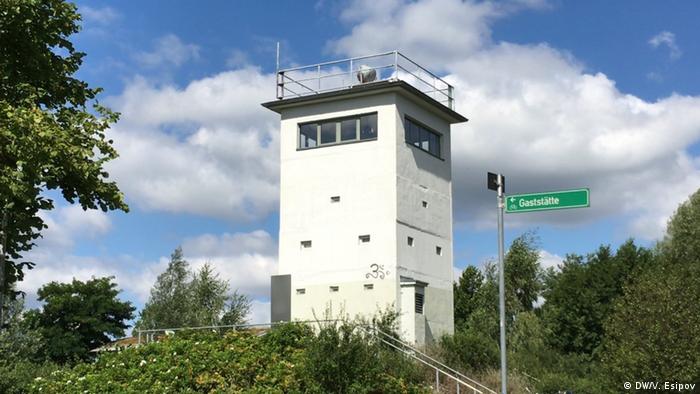
Old watchtower in Hennigsdorf
The historic route passes not only through urban areas, but also through suburban forests, along rivers, through meadows and fields. The sections where the Berlin Wall once stood outside the city were often the site of risky attempts by GDR inhabitants to escape to the West – for example, by swimming across the Havel. The museum in the former watchtower in Hennigsdorf is dedicated to life in these places during the Wall’s existence.
Sakura instead of a wall
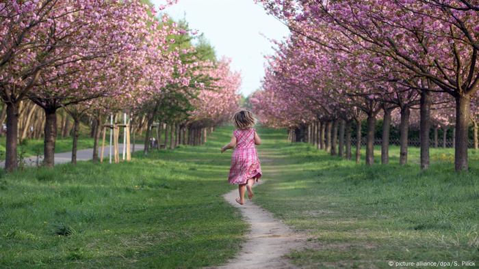
Spring on Bornholmer Strasse
Some areas on the old border were planted with sakura. The trees were donated by the people of Japan, who wanted to express their joy at the reunification of Germany. In spring, you can admire its flowering, for example, in the district of Pankow, near the bridge on Bornholmer Strasse, where the first checkpoint was located, opened on the night of the fall of the Berlin Wall on November 9, 1989.
Source: DW
Lori Barajas is an accomplished journalist, known for her insightful and thought-provoking writing on economy. She currently works as a writer at 247 news reel. With a passion for understanding the economy, Lori’s writing delves deep into the financial issues that matter most, providing readers with a unique perspective on current events.