
As a result of recent eruptions in Nord Stream pipelines in the Baltic Sea, judging by satellite imagery.
Although they don’t have exact data on the leak in the Nord Stream pipelines, the researchers say they are certain it happened. more methane in relation to one similar incident which was noted last year in Gulf of Mexico. Then from the oil and gas facility In just 17 days, 40,000 tons of methane were released.amount equivalent to 3% annual emissions Mexico in one year.
🔎Landsat8 images observed today indicate the scale #methane emissions. From 26 to 29 September, the visibility radius of the bubbles was noticeably reduced from approx. 700 meters to approx. 520 meters. pic.twitter.com/i4jeUpW3iA
— International Methane Emissions Observatory (@CH4Observatory) September 29, 2022
The United Nations Observatory on Global Methane Emissions, in collaboration with the Polytechnic University of Valencia, note that the leak this time it’s even more.
Methane, which is the main component of natural gas, is one of the strong greenhouse gas80 times more potentially “dangerous” for global warming than carbon dioxide.
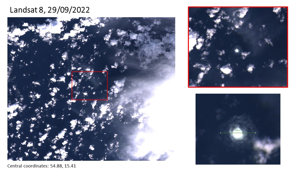
At the same time, the researchers analyzed satellite images and found that on September 29, the radius of the characteristic circle formed by the escaping gas decreased to 500 meterscompared to 700 meters on September 26th.
So far, four leaks have been discovered in the two Nord Stream gas pipelines that transport natural gas from Russia to Europe. Many governments have spoken out about pipeline sabotage. Denmark calculated that air ducts will be empty by sunday.
According to Bloomberg
Source: Kathimerini
Lori Barajas is an accomplished journalist, known for her insightful and thought-provoking writing on economy. She currently works as a writer at 247 news reel. With a passion for understanding the economy, Lori’s writing delves deep into the financial issues that matter most, providing readers with a unique perspective on current events.