
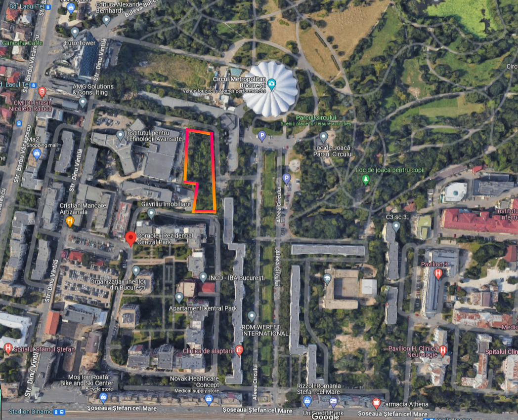
A 14-story block could appear behind Bucharest’s Circului Avenue, right next to Circului Park, in an area with a narrow and congested street. The developer applied for a town planning certificate for the 14-story building in May, and District 2 City Hall issued the document based on Sector 2’s PUZ. Sector 2 Mayor Radu Mihaju says he did not issue the document. construction permit, urban planning certificate is only an act of information that he is obliged to provide.
The zoning plan of sector 2, approved by the Firea administration, provides for this land: unlimited height, POT (percentage of land occupation) – 70% and CUT (coefficient of land use) – 4.5. Currently, the City Hall of the 2nd sector cannot give permission for a 14-story building, because the zoning permit of the 2nd sector, which allows the concreting of dozens of hectares of green spaces and inter-house blocks, has been suspended by the court.
“On Circus Alley, the documentation for a permit has not even been submitted. A design certificate was requested and sent to the owner, but after the certificate was issued, no documentation was submitted for authorization. The urban planning reference also provides for a geotechnical study to see what the water level is, conclusions were also requested from the MAI, the Research Institute, the conclusions are difficult to obtain. A town planning opinion was requested for quarter P+14, on the zoning district of Sector 2. The zoning district of Sector 2 was suspended, the town planning act was issued when it was valid. I remind you that the local government is obliged to issue a town planning certificate for the object requested by the developer within 15 days. Site board is mandatory. If the works are carried out without a construction site sign, I ask the citizens to inform the local police,” the mayor of Sector 2, Radu Mihaj, told HotNews.ro.
In Sector 2 Facebook groups, people are asking the City Hall not to approve such a real estate project. It was reported last week when construction equipment arrived on the field.
HotNews requested ANCPI to obtain an extract from the land deed, according to the document, the land with an area of about 3,200 square meters belongs to H&S PROJECT DEVELOPMENT SPV SRL. It was bought from GEORGE DAVID ALEXANDRA in July 2023, the purchase price was 5.5 million euros, of which two million euros have been paid so far and the rest is mortgage rights. According to termene.ro, the shareholder of H&S PROJECT DEVELOPMENT SPV SRL is an offshore company from Cyprus, and the administrators are MACHAT SHAHAR, TELELMAN ZIV-ASHER. They are administrators in almost all companies of the developer with Israeli capital Hagag Development Europe.
The urban planning certificate issued by the City Hall of Sector 2 in May 2023 was requested by another company – SC TOP RESIDENCE TD SRL – for “construction of a mixed-use residential complex with height regime 4S+P+14E, fence”. , engineering connections avenue Circului no. 5″.
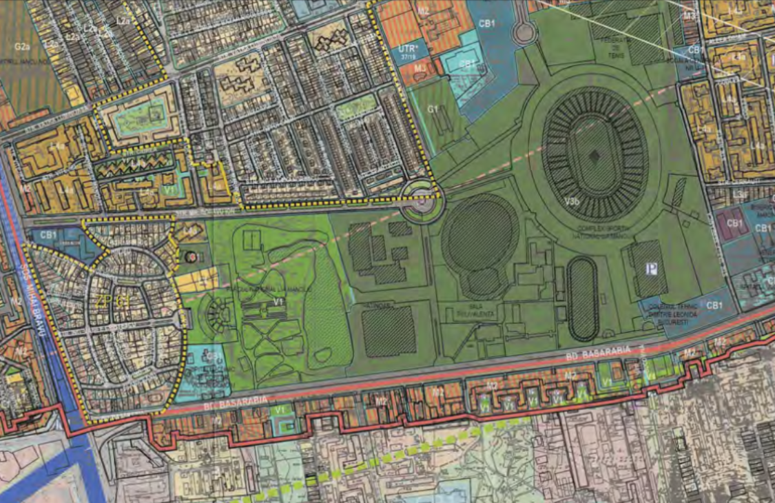
In the General Urban Development Plan, 3,200 square meters are included in the CB1 zone – the territory allocated for public institutions. The height of buildings that can be built here is determined by the width of the street. As the land has a frontage of approximately 9 metres, the permitted height would be 3 storeys.
On the PUZ sector 2, however, CB3, where the height is unlimited, and the city indicators: POT – 70% and CUT 4.5.
About PUZ Sector 2
In June, a Bucharest court suspended and annulled the Sector 2 PUZ approved by the Firea administration, which allowed the concreting of tens of hectares of green spaces. A lawsuit has been filed with the UED, the decision can be appealed.
“Cancel the CGMB Decision no. 339/13.08.2020 regarding the approval of the Zonal City Plan – Sector 2 Bucharest. Suspends the implementation of CGMB Decision no. 339/13.08.2020 regarding the approval of the Zonal Urban Development Plan – Sector 2 of Bucharest until the final decision of the case”, is the decision of the Bucharest Court, issued on June 7.
In March, another process to cancel the “Sector 2” PUZ, initiated by the “Ecopolis” association, was lost at first instance, also in the Bucharest court. The appeal is currently being considered.
Between the two controversies, the Sector 2 City Hall issued several permits for the Sector 2 PMU, which have now been suspended and revoked. Sector 2 Mayor Radu Mihaju says he could no longer keep all the documentation.
Early last year, the Bucharest court suspended all PUZs for sectors 2, 4 and 5 pending the annulment decision. Sector 3 and 6 PUZs have already been canceled and Sector 5 PUZ was also canceled last year.
Prior to this decision, on February 26, 2021, the PNL-USR majority in the General Council approved a one-year suspension of the zonal city plans for sectors 2, 3, 4, 5 and 6, on the proposal of Mayor Nikusor Dan.
PUZ of sector 2 was approved on August 13, 2020.
The reason for the suspension of documentation in 2021 was cited by Mayor Nikushor Dan as the decrease in the area of green spaces.
- “The proposed PUZ balance envisages the area of green spaces in the amount of 422.53 hectares, which is less than the area of green spaces for public use, registered in the Register of green spaces, which was approximately 444 hectares.
- Reduction of green spaces is authorized, except for the invalidity of documents, Art. 96 OUGnr. 195/2005 and Art. 23 of Law No. 24/2007 with a fine for each square meter of affected green area. The reduction of green spaces is not appropriate even in light of the air quality violation procedure that the European Commission opened against Romania due to the poor air quality in the capital.
- In conclusion, the repurposing of the green spaces provided for as such in the PUG, and finally the reduction of the green spaces in Sector 2, is a violation of the right of the residents of the Municipality of Bucharest to a healthy environment. , therefore the PUZ Coordinator, Sector 2, is neglecting the basic public interest,” said the approval report signed by Nikusor Dan.
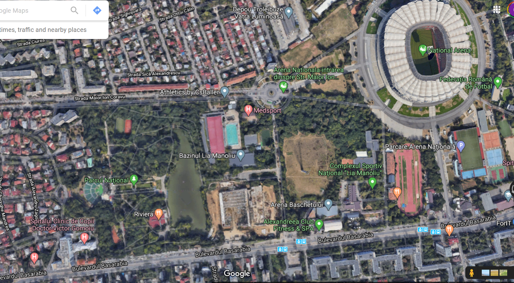
HotNews.ro wrote – starting from the public discussion phase – that the document allows for the transformation of more than 30 hectares of land on the shores of the Kolentina, Tay, Plumbuita and Fundeni lakes, as well as from the park near the National Arena, from green spaces to areas where blocks and houses can be built.
Among the territories where the change in the purpose of green spaces has been agreed are: the former sports base of RADETU on Calea Floreasca, the territory at the intersection of bldg. Barbu Văcărescu with Țițeica Street, the area where the Bamboo Club is built, the area of the former nurseries in Petrican, Tibiscum Island in Lake Fundeni and part of the green area at the National Arena. These lands are private property, most of them are retroduced.
Also, in some neighborhoods of buildings, such as Andronakhe, the height regime has been increased to 14 floors. The same is the case between the area between Lakes Fundeni and Lakes Dobrojesti. This means that people who own houses in these areas can always find blocks in their windows.
What are the main changes for green spaces
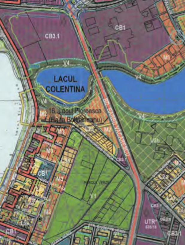
The former sports base of RADET, located in Calea Floreasca and bd. Barbu Văcărescu turns from a green zone (V 3b) into a CB 3.1 area, which means “a sub-zone of the main urban poles that group complex functions”. According to the regulation, urban planning figures of POT (percentage of land occupation) of 70% and CUT (coefficient of land use) of 4 are allowed in this area, and the maximum height is not limited. The sports base occupies almost 39,000 square meters and is located at Calea Floreasca 240. It was handed over back in 2004.
According to the previous norms, the sports base is listed in the General Plan with a green code, and the urban planning indicators related to it are 30% POT, 0.35 PPE, and the maximum height is two floors.
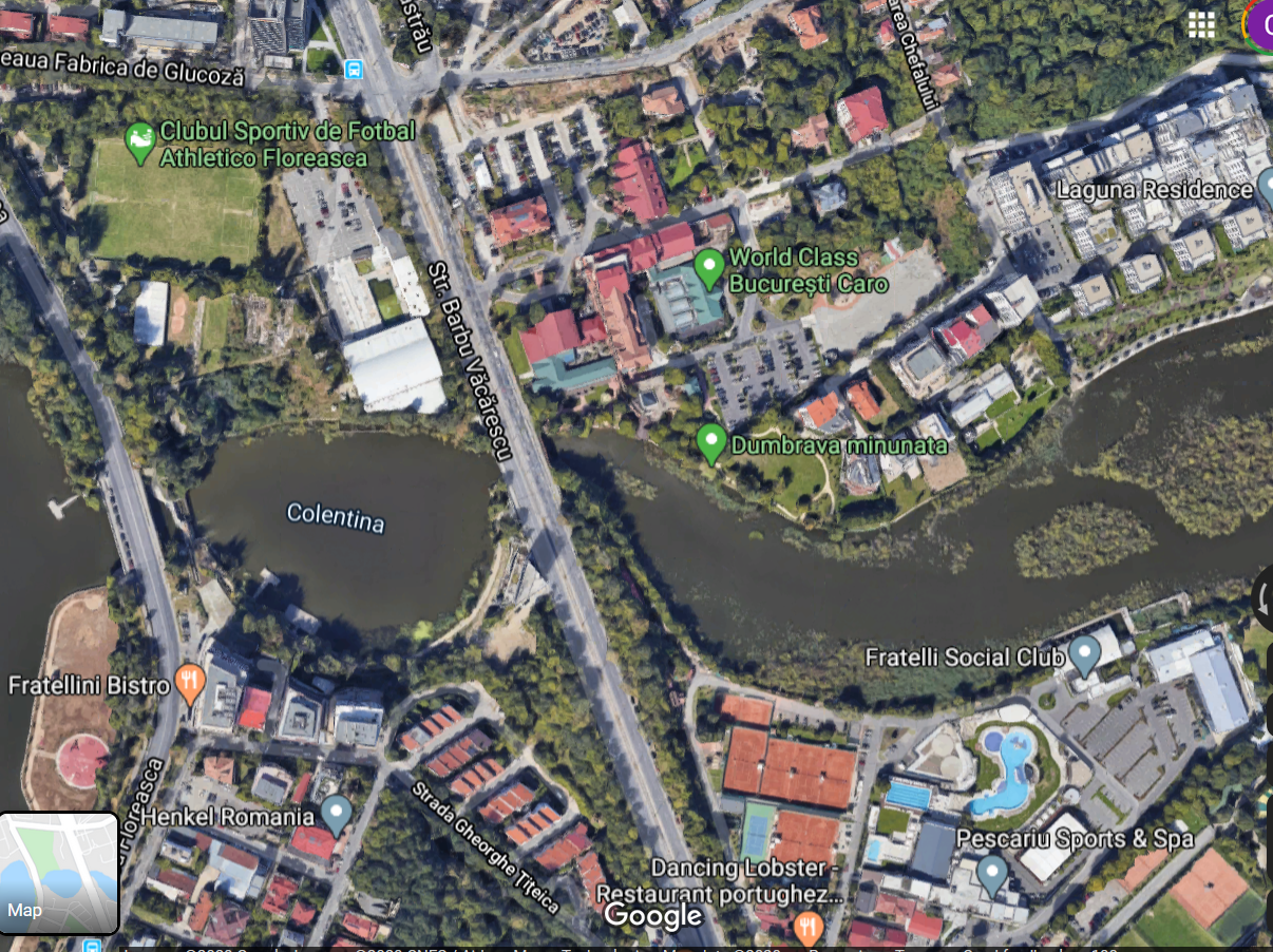
Next, a plot of land with an area of almost 1 ha, located at the intersection of bldg. Barbu Văcărescu with Țițeica street turns into M2 district. Permissible town planning parameters on this site are 70% of land use, 3.5% of clearance, maximum height – 45 m.
The current regulation is the General Plan
Provision proposed by the Coordinating Urban Development Sector 2
Satellite image – Google Maps
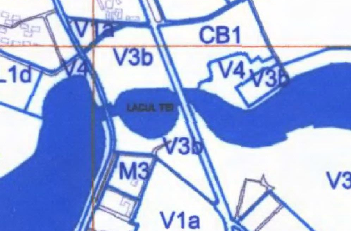
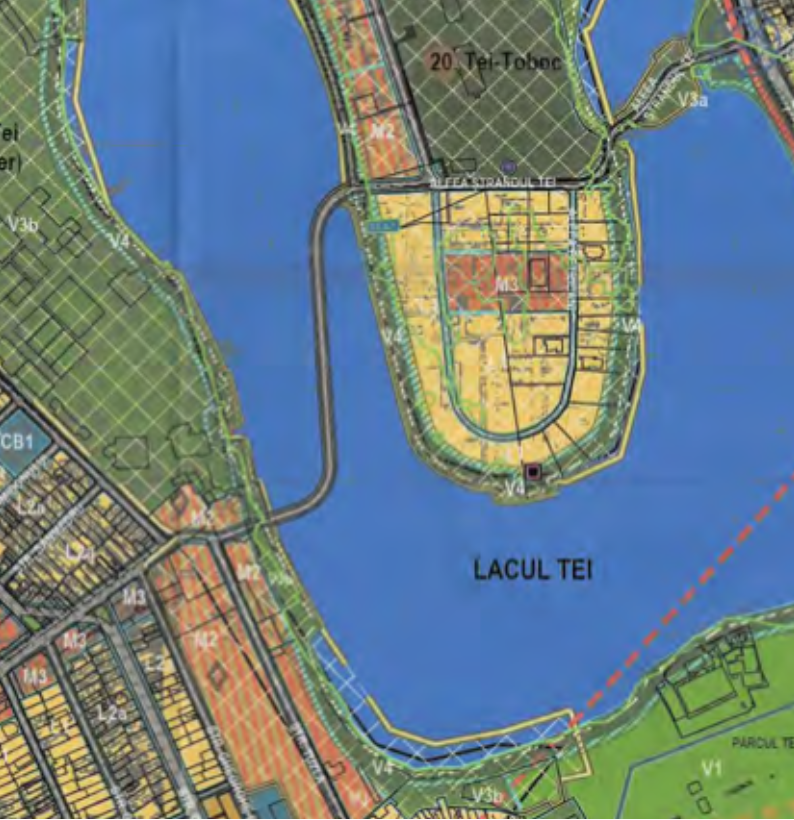
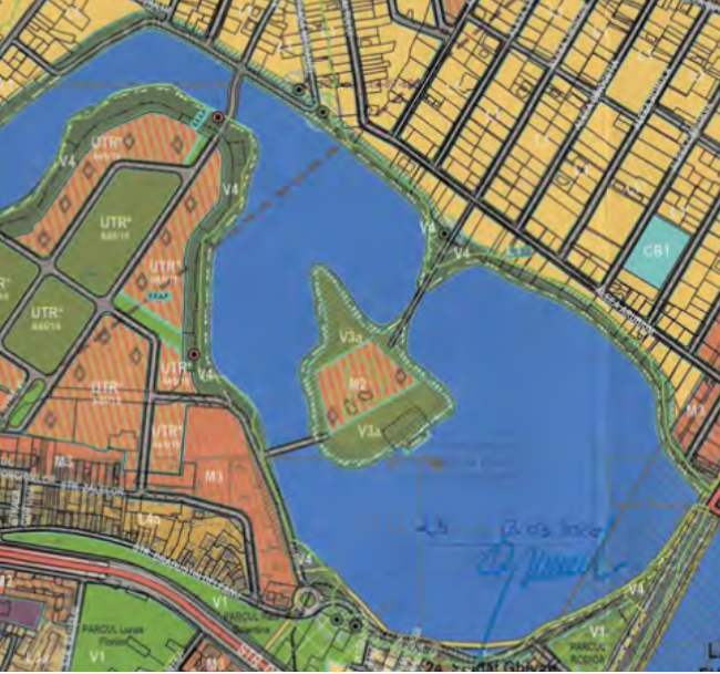
On the shores of Lake Tay, the area with the Bamboo Club has been moved from the V3b and V4 classification to the M2 zone, and even a part of the water shine, where the club’s pontoon is located, has been set aside. In the General Plan, the territory is indicated as V3b, green zone.
On the peninsula in the middle of the lake, which is listed as V3a in the General Town Planning Plan, that is, a green zone, in the Coordination Plan for the Development of Sector 2 there is a strip in zone M3 with the following town planning indicators: POT 60%, ЗРИЗ 2.5, maximum height – 25m.
In total, about 2.5 hectares of green areas were affected, including the water surface on which the pontoon is located.
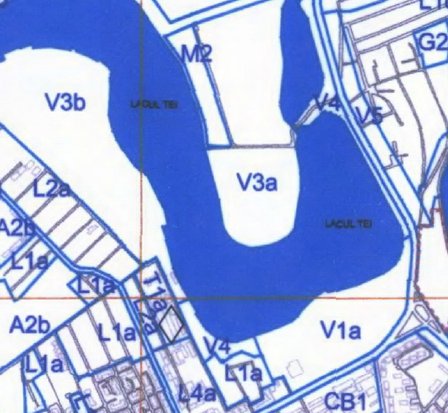
The current regulation is the General Plan
Provision proposed by the Coordinating Urban Development Sector 2
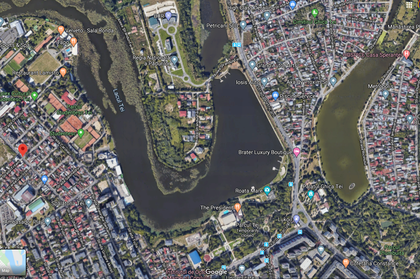
Satellite image – Google Maps
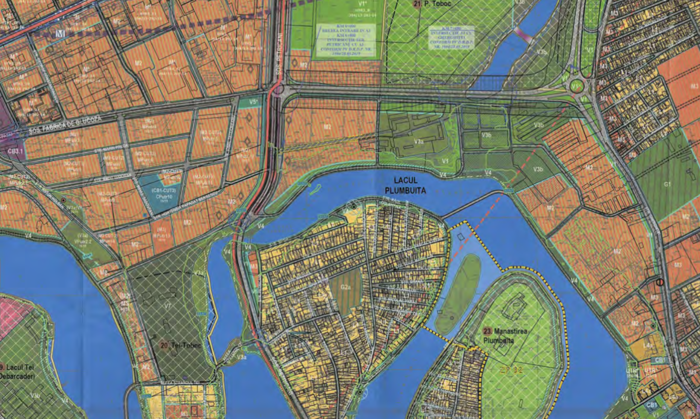
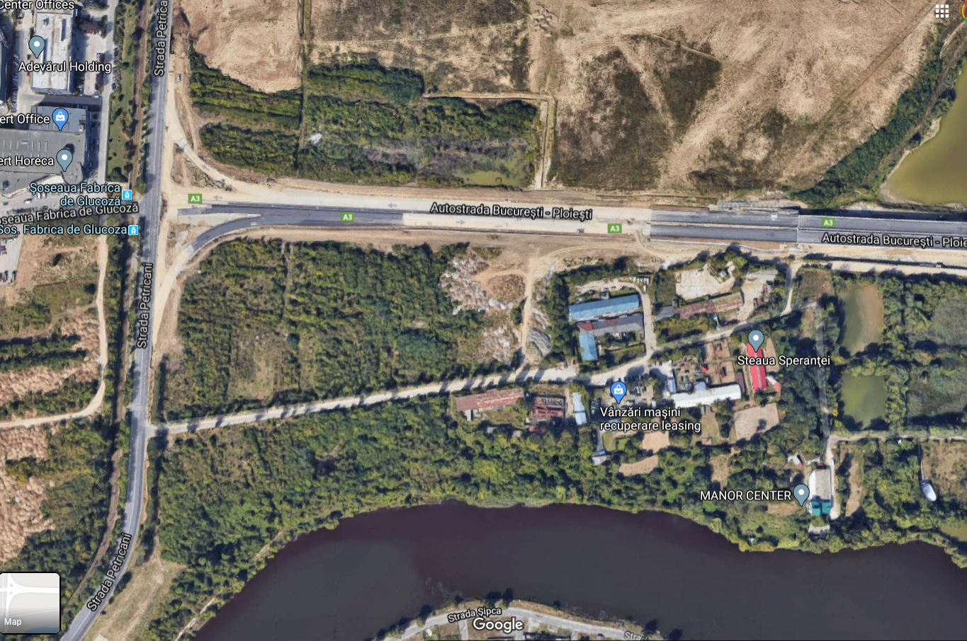
The 8.5 hectare plot of land at the intersection of Petrychany road with the A3, which is currently listed as a green area, is being converted by the coordinator of sector 2 of the PUZ into an M2 area – a sub-zone of mixed areas with high-rise and very high-rise buildings M2, POT 70%, SLOPE 3.5 , the maximum height is 45 m.
Also here, another plot with an area of about 2.7 hectares was changed from a green zone to M2.
The current regulation is the General Plan
Provision proposed by the Coordinating Urban Development Sector 2
Satellite image – Google Maps
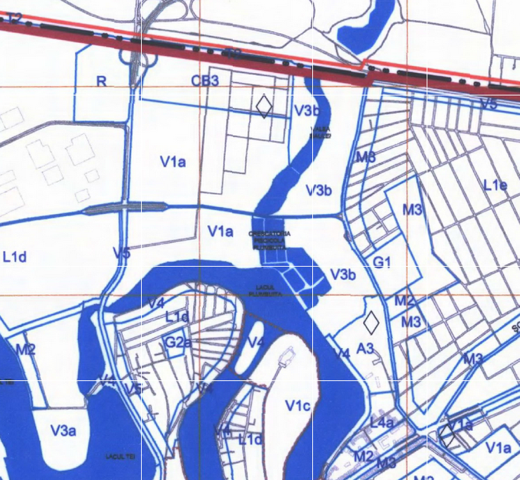
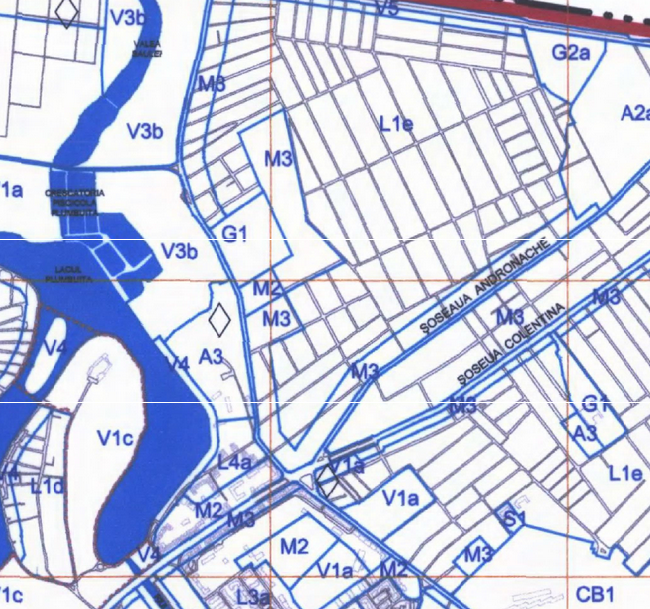
A little higher, in the direction of Andronachi road, at the intersection of the Valea Saulei – CF Cta area, a plot of land with an area of about 2.7 hectares has been converted from a green zone (V3b) to M2 (POT 70%, CUT 3.5, maximum height – 45 m ) .
Also here, the former Piscicola Valea Saulei enterprise, a plot of land with an area of 2.8 hectares, is being converted from a green zone to M2 (POT 70%, CUT 3.5, maximum height – 45 m).
The current regulation is the General Plan

Provision proposed by the Coordinating Urban Development Sector 2
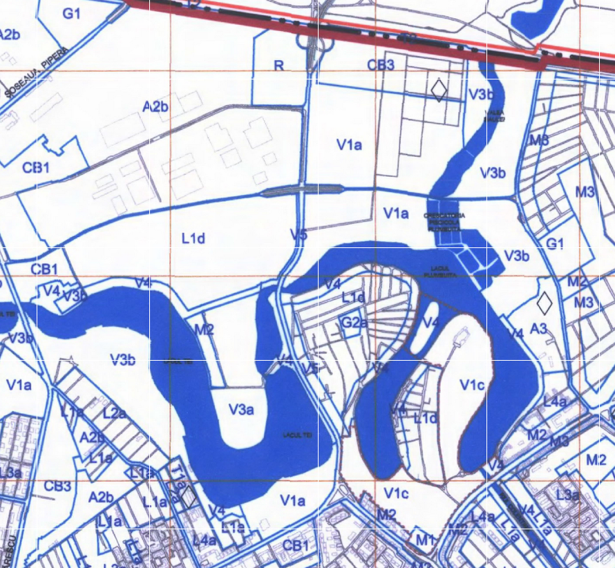
On the site between Gherghiței street and Lake Plumbuita, where Supercom headquarters are also located, a plot of land of about 8.4 hectares is proposed, which is currently classified as green space (V3b – green space – complexes and sports facilities”). classified in zone M2, subzone of mixed areas with tall and very tall buildings (POT 70%, CUT 3.5 Hmax – 45m). Part of the land that receives the function M 2 belongs to Supercom.
The current regulation is the General Plan

Provision proposed by the Coordinating Urban Development Sector 2
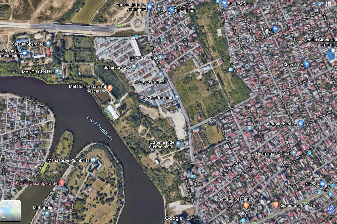
Satellite image – Google Maps
On the island of Tibiscum, on Lake Fundeni, on an area of 0.9 hectares, it is proposed to change the urban planning function from the green zone (V) to the M2 zone (POT 70%, CUT 3.5, maximum height – 45m).
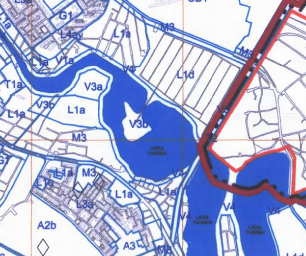
The current regulation is the General Plan
Provision proposed by the Coordinating Urban Development Sector 2

Satellite image – Google Maps
On the street of Architect Harieu near the national park “Lia Manoliu” on an area of 0.9 ha, the situation is changing from public green areas – a park to an area where houses can be built. Satellite images show that several houses have already been built on this site. Only authorized institutions can find out how it was possible to allow some constructions on green areas, who allowed them.
The current regulation is the General Plan
Provision proposed by the Coordinating Urban Development Sector 2
Satellite image – Google Maps
The coordinating urban plan of sector 2 was developed by the Urbe 2000 architectural bureau.
According to Article 71 of GEO 195/2005, reissued on environmental protection:
- (1) It is prohibited to change the intended use of lands arranged as green spaces and/or provided as such by urban planning documentation, their area reduction or relocation, regardless of their legal status.
- (2) Administrative or legal acts issued or concluded in violation of the provisions of par. (1) lose absolute invalidity.
According to Law 135/2014, green spaces in private ownership, which in the land cadastre are classified as yard buildings, cannot be inventoried or declared as green spaces without expropriation of the corresponding lands.
However, in cases where the case went to court, in most cases, the judges decided that green areas should be protected regardless of the ownership regime.
Source: Hot News
Ashley Bailey is a talented author and journalist known for her writing on trending topics. Currently working at 247 news reel, she brings readers fresh perspectives on current issues. With her well-researched and thought-provoking articles, she captures the zeitgeist and stays ahead of the latest trends. Ashley’s writing is a must-read for anyone interested in staying up-to-date with the latest developments.