
Severe storms continued for another day over much of the eastern mainland and insular portions of the Aegean.
According to the dense network of automatic weather stations of the National Observatory of Athens/meteo.gr, the most precipitation in our country was 102 millimeters and was recorded at the weather station in Kavotoros.
In Attica, the largest amount of precipitation was recorded at the weather station in Agios Stefanos and was equal to 63 millimeters.
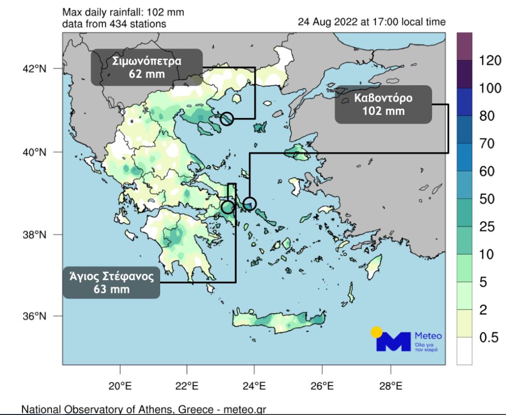
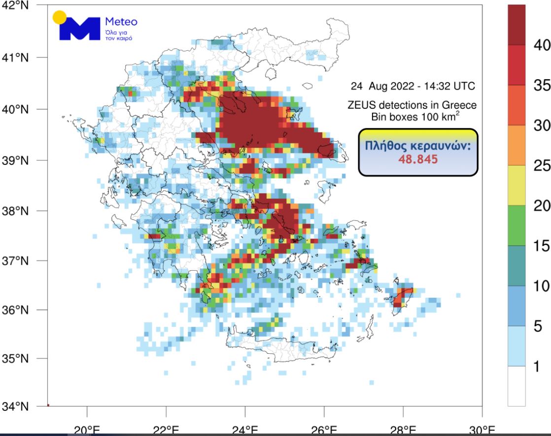
At the same time, in our country, the Zeus lightning registration system recorded almost 50,000 lightning strikes until 17:00 on Wednesday 24 August.
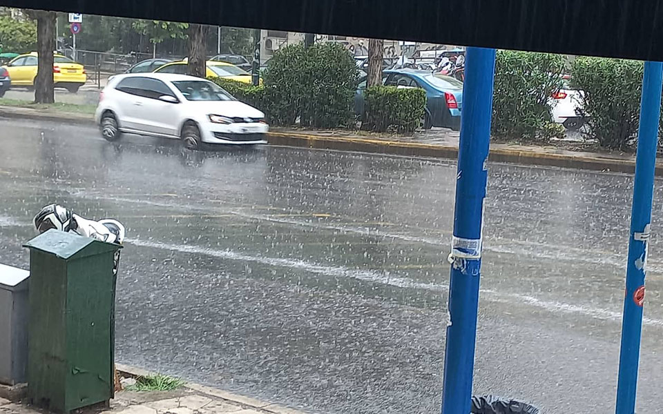
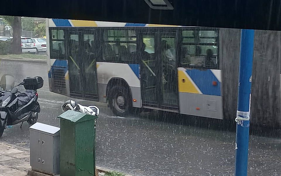
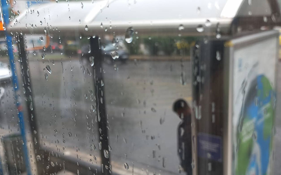
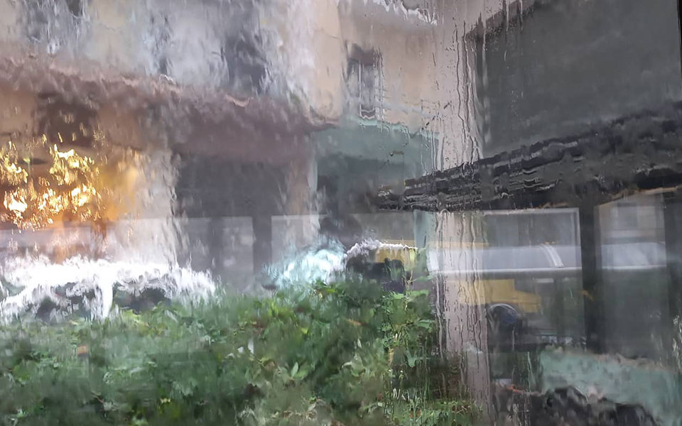
The heavens “opened” in Attica
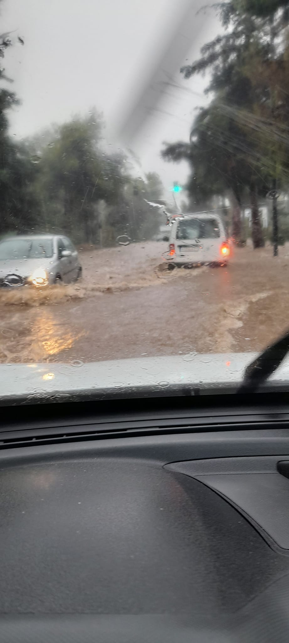
After yesterday’s storm, heavy rain hit Attica again shortly after 11:15 am on Wednesday and also in the afternoon.
Due to subsidence of the road surface, the movement of vehicles was stopped on the right lanes of Piraeus Street in both streams, at the height of Milleru Street.
The drivers were imprisoned in Dionysus.
It also rained heavily in the northern suburbs of Attica, and problems were also recorded in Keratsini.
Due to the accumulation of water, drivers were stuck on Drosias – Stamatas Avenue, in Dionysos. Firefighters arrived at the scene and evacuated them.
In the morning, the fire department received 60 calls for help and pumping water in the regions of Attica.
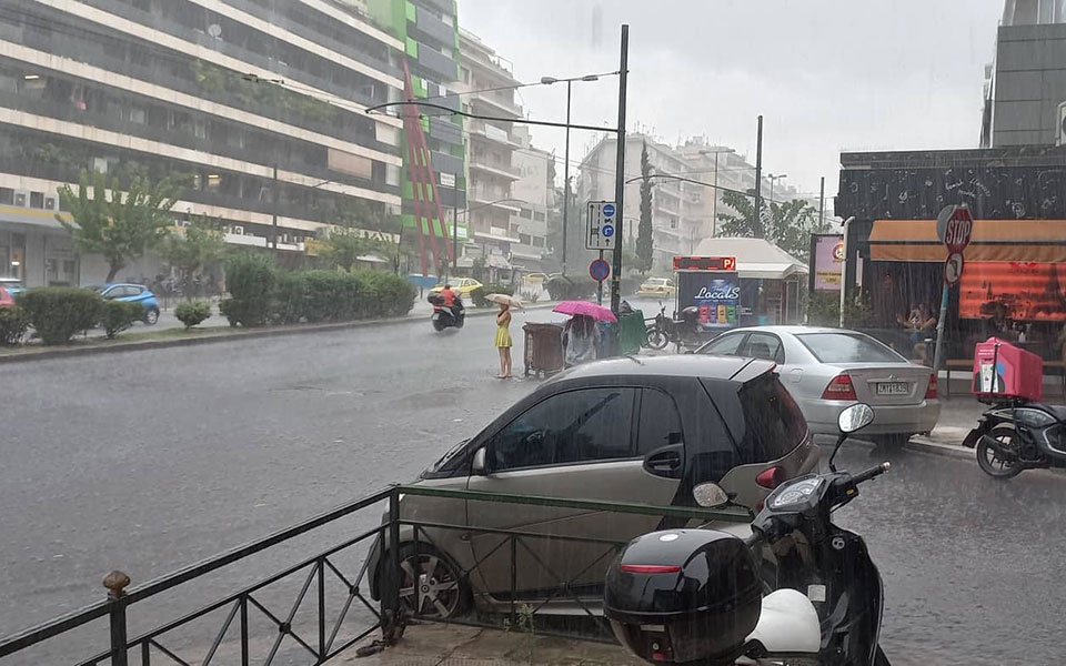
Images of L. Alexandras in the afternoon
Video/photo: Lukas Velidakis
Heavy rain in the center of Athens, Wednesday 24 August. pic.twitter.com/7ffzldZMIk
— Lukas Velidakis (@UrbanRat7) August 24, 2022
Heavy rain, Wednesday, August 24, central Athens. pic.twitter.com/MkvOy67BDB
— Lukas Velidakis (@UrbanRat7) August 24, 2022
Heavy rain, central Athens, Wednesday 24 August. pic.twitter.com/ssXJ2ZFyxJ
— Lukas Velidakis (@UrbanRat7) August 24, 2022
Evia – Thessaly
In Ahladi, in the north of Evia, residents are worried about large volumes of water and portable materials coming off the burnt areas.
In Western Thessaly, which was at the center of the storm on Tuesday afternoon, roads in Kalambaka were flooded, while power supply problems and rockfalls were recorded in the Karditsa mountains, ERT reported. In addition, lightning struck the roof of a house in Redina.
Severe weather in Central Macedonia
Heavy rains and storms have been going on since early morning over most of it. Central Macedonia. Bad weather, as predicted by EMY, “spreads” gradually. According to the Regional Meteorological Center of Macedonia, the center of the storm is moving from the southeast and Chalkidiki to the northwest of the region.
Rain and storms will move over a wider area on Wednesday morning, with the events being intense in places and at intervals.
The islands of the Aegean Sea “sank”.
The rains did not bypass those who still enjoy their holidays on the islands of the Aegean Sea.
Problems were recorded due to intense phenomena in Santorini where there were landslides in the harbor and power outages.
“We mobilized 5 vehicles, as there were also landslides in the port, there were no problems in navigation. Vigilance is necessary because this is a tourist area, and accommodation businessmen must inform tourists about intense phenomena on the island, ”Giannis Artopios, spokesman for the fire department, said earlier in the r / s Proto program.
A severe storm also hit Mykonos. An amateur video shows a tornado that formed in the Kalafati area.
Tomorrow the storm will continue
Bad weather with rain and storms will prevail in most parts of the country tomorrow, Thursday, while local phenomena will be intense mainly in the central and northern regions, with an emphasis on parts of North Macedonia, North Thessaly, Northwest, North Evia. , Sporades and the North Aegean Sea. According to the weather service of the National Observatory of Athens, thunderstorms in Epirus and Western Macedonia are likely to be accompanied by a local hail of a small size.
Temperature
Temperatures will drop slightly in the central and southern continents, while locally rise slightly in the northwestern continents, and will fluctuate, according to meteorological information from the National Observatory of Athens:
- in Western Macedonia from 14 to 27-28 degrees,
- in the rest of Northern Greece from 16 to 33-34,
- in Epirus from 14 to 28-30 degrees,
- in Thessaly from 14 to 30-31,
- in the rest of the continent from 15 to 27-28 degrees,
- in the Ionian Islands from 18 to 29-30,
- on the islands of the Aegean Sea and Crete from 18 to 27-28 degrees Celsius.
Winds
Winds in the Aegean will blow from various directions with force up to 3-5 Beaufort, except in the most southern areas where they will blow from the western general directions with force up to 4 Beaufort. North-westerly winds up to 4-5 on the Beaufort scale will blow in the Ionian Sea.
What is the weather like in Athens and Thessaloniki tomorrow?
Temporary clouds are expected in Attica, while showers and thunderstorms are expected in the afternoon and afternoon hours. The effects are likely to be intense in some places. The wind will blow from various directions with a force of up to 2-3 on the Beaufort scale. The temperature will fluctuate from 23 to 29-30 degrees.
Thessaloniki is expected to be partly cloudy with occasional showers or even thunderstorms. Phenomena in the morning hours are likely to be intense. The wind will blow from various directions with a force of up to 2-3 on the Beaufort scale. The temperature will fluctuate from 23 to 32-33 degrees.
Report from 112 about dangerous phenomena in seven districts
Warning message from the Civil Protection emergency service “112”for dangerous bad weather events over the next 48 hours, it was sent to seven regions of the country.
In particular, the warning applies to:
- coastal regions of Eastern Macedonia – Thrace,
- coastal regions of Central Macedonia
- islands of the North Aegean Sea,
- Thessaly,
- Sporades,
- regions of Eastern Central Greece,
- Evia
Citizens in these areas are asked to avoid unnecessary travel and follow the instructions of the authorities.
⚠️ Activation 1️⃣1️⃣2️⃣
???? Severe weather events in the next 48 hours:
????The coastal regions of North Macedonia-Thrace and K. Macedonia, the islands of the North Aegean, Thessaly, Sporades, the regions of North Central Greece and Evia
‼️ Avoid unnecessary movements – Follow the instructions of the Authorities
— 112 Greece (@112Greece) August 24, 2022
Post to Thessaloniki as well
A message from “112” about dangerous weather events that will affect the area in the next 48 hours was sent at 13:30 to the residents of Thessaloniki.
A warning message “arrived” on mobile phone screens speaks of storms, rapid rain and thunderstorms over a wider area, and citizens are asked to avoid unnecessary movement during intense events while following self-protection instructions.
In addition, the Autonomous Directorate for Civil Protection of the Central Macedonia Region has announced that EMY/EMK has issued an Emergency Hazardous Weather Notice effective today, Thursday 24 August.
Emergency medical opinion
An emergency weather bulletin is in effect, bad weather has been raging over the country for the past 24 hours, and EMY is warning of dangerous weather events in the next few hours with its new bulletin.
???? From today to tomorrow night, dangerous weather events are predicted in a number of areas ‼️
⛈️ Heavy rains, thunderstorms and lightning⚡️
????️ Hail and strong wind????We avoid moving and always follow the instructions of the Authorities ⚠️
???? https://t.co/1JgPxVNllm pic.twitter.com/Nj1F7BHW1b
— Civil Protection GR (@GSCP_GR) August 24, 2022
Heavy rains and thunderstorms are expected in most regions of the country until Friday, accompanied by a high frequency of thunderstorms, hail and temporarily, during phenomena, strong gusty winds.
However, according to the latest forecast data, the current weather report on the worsening of the emergency is being updated to Emergency Hazardous Weather Bulletindue to heavy rainfall and the rapidity of events, from tonight (Wednesday, August 24, 2022) to tomorrow evening (Thursday, August 25, 2022) for the following areas:
- For the coastal parts of eastern Macedonia and Thrace and the islands of the northern Aegean (mainly Lemnos, Samothrace and Thassos) from early evening today until the morning hours of tomorrow Thursday.
- For central Macedonia (mainly the prefectures of Chalkidiki, Pieria and Imathia, as well as for the coastal parts of the prefecture of Thessaloniki) from tonight until noon tomorrow Thursday.
- For Sporades, Thessaly (mainly the prefectures of Magnesia and Larisa), central and northern Evia and the northern parts of eastern Sterea (mainly the prefecture of Phthiotis) from tonight until tomorrow Thursday night.
Source: Kathimerini
James Springer is a renowned author and opinion writer, known for his bold and thought-provoking articles on a wide range of topics. He currently works as a writer at 247 news reel, where he uses his unique voice and sharp wit to offer fresh perspectives on current events. His articles are widely read and shared and has earned him a reputation as a talented and insightful writer.