
In the first half of August 2022, the level of the Rhine in the Cologne region dropped below one meter – very low, but still not a record. A prolonged drought has already led to a partial restriction of freight transport here, as DW reported. Where and how are these indicators monitored?
Live on the Rhine – live with the Rhine
Much water has flowed under the Rhine since the time of the ancient Romans, who founded their first settlements on the banks of this river some two thousand years ago. Later, they became the present-day German cities – Speyer, Worms, Mainz, Koblenz, Bonn, Cologne, Xanten. Many different floods have seen and will see the inhabitants of these and other cities on the Rhine. The most severe occurred in the winter of 1784, and of the last, the most severe were the floods of 1993 and 1995.
Pai Rhine near the town of Speyer, surrounded by several of its many tributaries – the Iller, Dreisam, Os and Neckar rivers. Allegorical images in the painting of Moritz Ludwig von Schwind (Moritz Ludwig von Schwind, 1804-1871)
Father Rein (Vater Rhein, aka Rhenus) is a fan of visits, but he doesn’t do it often, but according to his mood, depending on the weather. Sometimes it is limited to symbolic flooding of footpaths and coastal meadows. If he decides to really show a violent temper again, then he may, despite measures of resistance and protection, get to the basements and first floors.
Nothing to do. Living on the Rhine is living together with the Rhine, because the benefits of such a neighborhood are many times greater than the possible threats. For many centuries, people here have learned to deal with such surprises – build dams and quickly restore order after unwanted visitors. In recent years, hundreds of millions of euros have been invested in the construction of protective structures. At the same time, part of the selected floodplain territories is returned to the river, so that there is somewhere to be distributed – to pour the water.
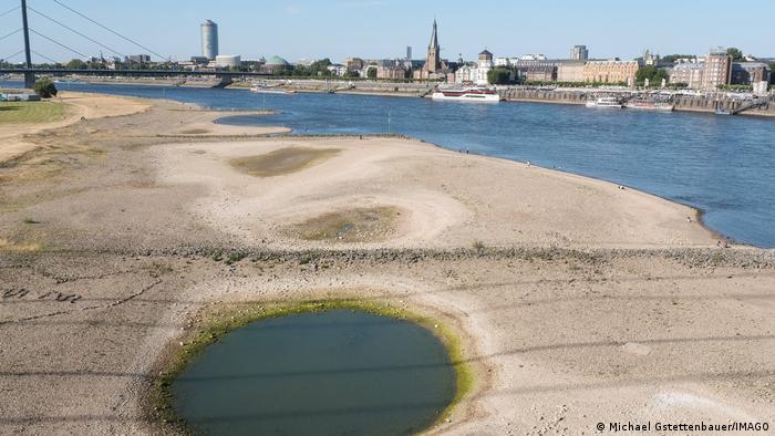
Bank and bank of the Rhine in Düsseldorf in July 2022
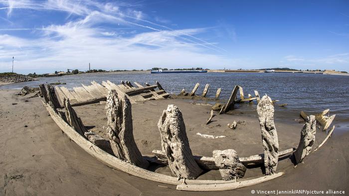
During a drought in the summer of 2022 on the Lower Rhine, near the town of Kleve, you can again see the wooden skeleton of a cargo ship that sank here in 1895 after the explosion of dynamite that was on board.
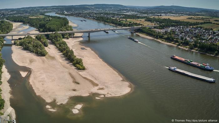
Bridge over the Rhine near the town of Bendorf in Rhineland-Palatinate in July 2022
The extreme manifestations of the Rhine’s indomitable character regularly alternate with periods of low water caused by long absences of rain and long periods of very hot weather. In the Cologne area, the lowest level ever recorded was recorded on October 23, 2018 – just 67 centimeters. Then the record set in September of the abnormally hot year 2003 was broken – 81 centimeters. Periods of drought enchant historians and archaeologists who, studying the bare bottom, look for traces of ancient Roman quays on the Rhine, for example, in the Bonn region. There are also unpleasant finds, such as unexploded bombs from WWII. Is it possible to ford such a shallow Rhine during these periods? No, but more on that later.
Rhine – the most important maritime artery
Floods and droughts are a particular headache for captains of the Rhine. Today, every day on the river, for example, on the stretch between Mainz and Koblenz, around 200 ships pass. There used to be even more. On the Rhine in Duisburg is the largest river port in Europe. In the last century, steel, coal and other goods were exported from the Ruhr region through it.
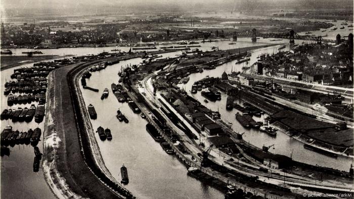
Rhine Port in Duisburg in the mid-1930s
Each modern river container ship replaces 100 trucks. River ships also transport liquefied gas, oil and other raw materials for the chemical industry, as well as bulky cargo – transformers, wind farm elements and even… spacecraft, or rather the Soviet Buran in 2008 for the Technical Museum in Speyer.
For captains, information about the water level is of great importance. It depends on how much cargo they can carry on a trip so they don’t run aground during periods of low tide or go under bridges during high tide. In addition, this data is constantly monitored by the services responsible in the cities and regions of the Rhine for flood protection. They are provided by special water metering stations.
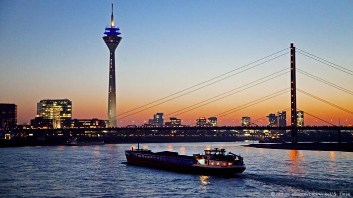
Rhine near Düsseldorf at normal water levels
Current data on the water level on the Rhine in Germany can be found by a single reference number – 19429, before dialing the city code of interest, i.e. for example for Bonn – 0228 19429 or 0211 19429 – for Dusseldorf. The results of the last measurements are reported 24 hours a day by an answering machine. Information can also be found on the Internet. For example, in Cologne – at this address: www.koeln.de/wetter/rheinpegel.
Water measurement stations and statistics
On 865 kilometers of the Rhine in Germany, 22 water metering points are operating continuously. The most important for transport are the automated stations located in Kaub and Cologne – “Pegel Kaub” and “Pegel Köln”. “Cologne Pegel” is located in a round tower on the busy edge of the Old Town. The round dial hands do not show the time of day, but the water level in the river.
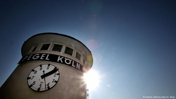
Cologne water station
Kaubsky Pegel is located on the Middle Rhine, a UNESCO World Heritage Site. This place is well known by tourists, thanks to the medieval Pfalzgrafenstein castle, built in the middle of the river. Regular water level measurements began to be carried out here in the mid-19th century, and a water measurement point was built in 1905. The Middle Rhine has always been and remains a difficult place for river navigation. The draft of the cargo ships, depending on the water level and the trend of descent or ascent in this section, can be from 80 to 120 cm, and the minimum depth of the race track is 2.1 meters.
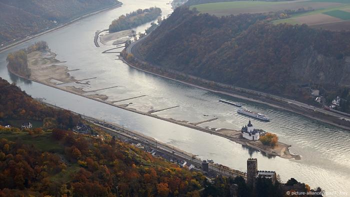
Middle Rhine near Kauba
In the Cologne region, systematic water level measurements began in 1771. About ten years later, they began to keep regular records. The first water measuring station was destroyed by ice floes during the record flood in 1784. In February, the Rhine rose here to a mark of 13.63 meters.
Data on earlier catastrophes are known from records in medieval chronicles and marks that have survived to this day on houses and buildings that were flooded with water. The oldest is dated July 1342 – 11.53 meters in the Cologne region. 680 years ago, the peak of this flood on the Rhine and many other rivers in Europe fell on Mary Magdalene’s day, so it was called – Magdalenenhochwasser.
Level zero – relative level
Data on the water level in the Rhine are relative data. The zero mark on the Cologne water scale is linked to the national altitudinal coordinate system and is several meters above the river bed. If the Rhine reaches zero, it doesn’t mean it has dried up completely. The Cologne Rhine Zero (Pegelnull) is set at 34,972 meters above the National Zero (Normalhöhennull). She, in turn, is at St. Alexander in Lower Saxony Wallenhorst. The normal average river level in the Cologne area is now 2.97 meters. The previous number was higher – 3.21 meters. It is calculated based on data from a decade.
Threat levels during the Rhine floods
During floods, two landmarks are of decisive importance for maritime transport in the Cologne region. The first is 6.2 meters, at which there are restrictions on the speed of ships in the river so that their waves do not destroy the coast. The second is 8.3 meters, at which the movement stops completely. The Old Town promenade, usually crowded and loved by tourists, is closed at a level of 9.8 meters. If the Rhine rises another 90 centimeters, an emergency flood protection plan is implemented in Cologne, namely the installation of a movable barrier – an additional wall of metal beams – begins.

The old town of Cologne during the floods in December 1993
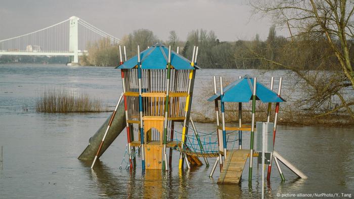
A flooded playground near the Rhine beach in Cologne in February 2020
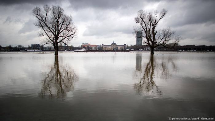
Trees near the Rhine in Düsseldorf in January 2018
The mobile system was developed after the 1993 and 1995 floods, which partially flooded the Old Town. The water level at the peak of the flood exceeded 10.6 meters. The new system protects this historic part of the city at a level of 11.3 meters. Total damage from the 1993 flood on the Rhine alone is estimated at around €500 million, of which €56 million in Cologne.
Experts calculated the possible damage from a severe flooding of the Rhine if there were no protective structures. In North Rhine-Westphalia alone, it can reach 130 billion euros. With global climate change and extreme weather on the rise, this investment in the future pays off.
Source: DW
Lori Barajas is an accomplished journalist, known for her insightful and thought-provoking writing on economy. She currently works as a writer at 247 news reel. With a passion for understanding the economy, Lori’s writing delves deep into the financial issues that matter most, providing readers with a unique perspective on current events.