
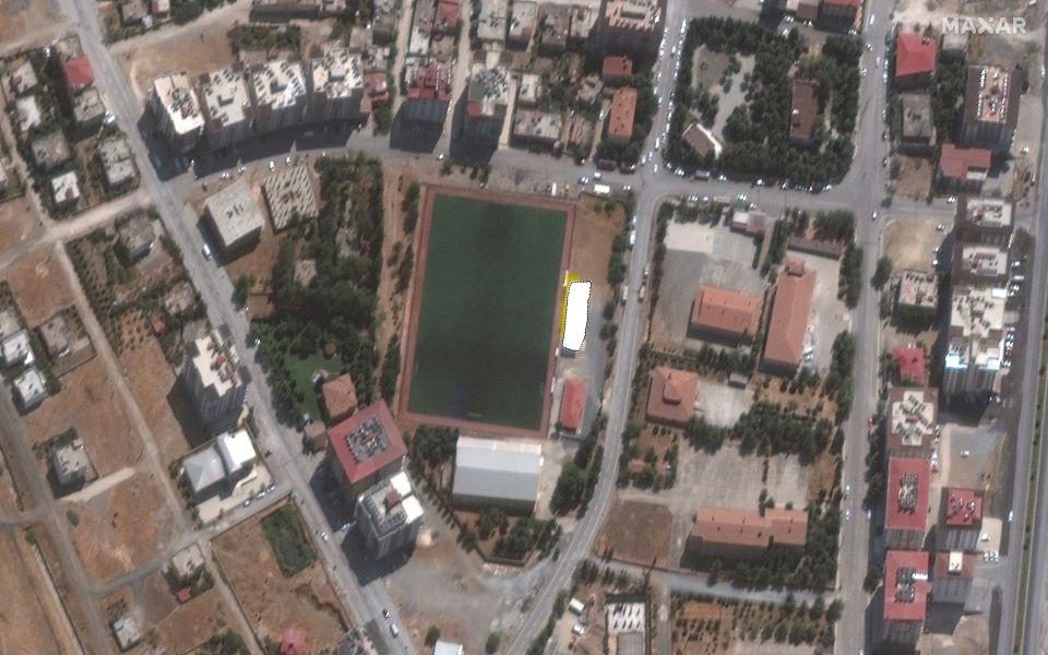
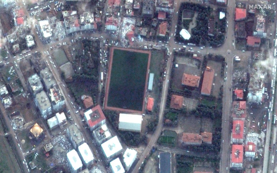
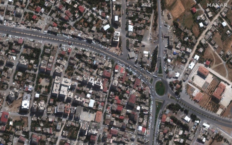
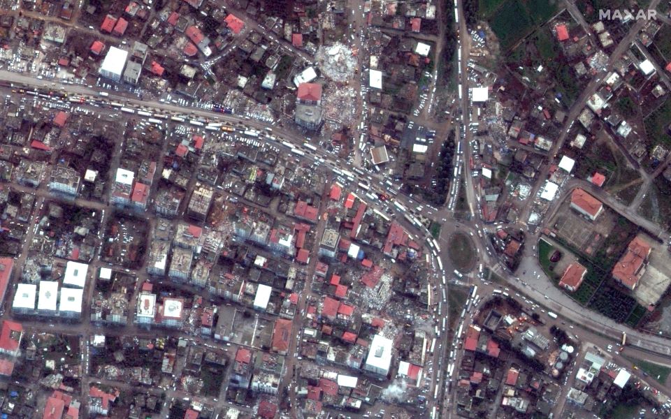
Indicates its power destructive earthquake magnitude 7.8 on the Richter scale Turkey that led to the death of at least 11,500 people are images taken by Maxar Technologies satellites.
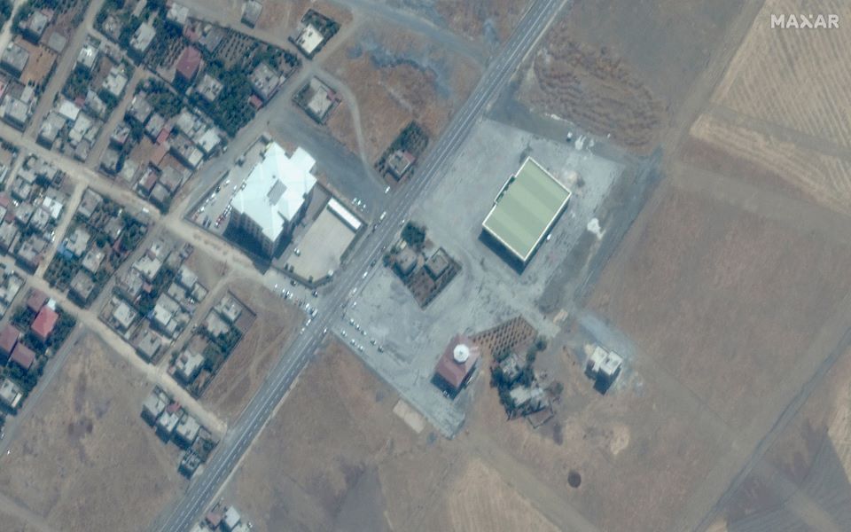
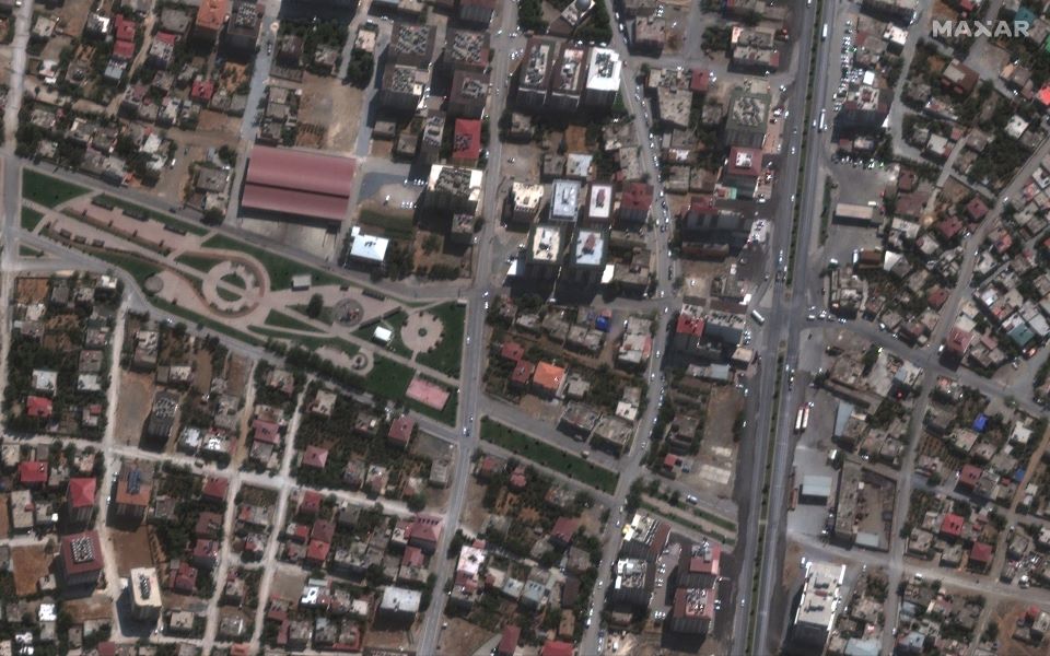
The images in question show areas before and after the February 6 earthquake.
In the city of Nurdagi in the province of Gaziantep, not far from the epicenter of the earthquake, the roofs of many buildings collapsed, and many buildings were completely demolished.
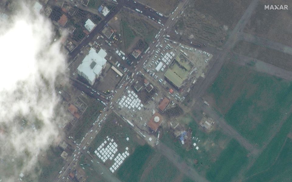
The images also show white emergency tents set up for earthquake victims, as well as traffic jams that arose on one of Nurdaga’s main arteries in the hours after the main shock.
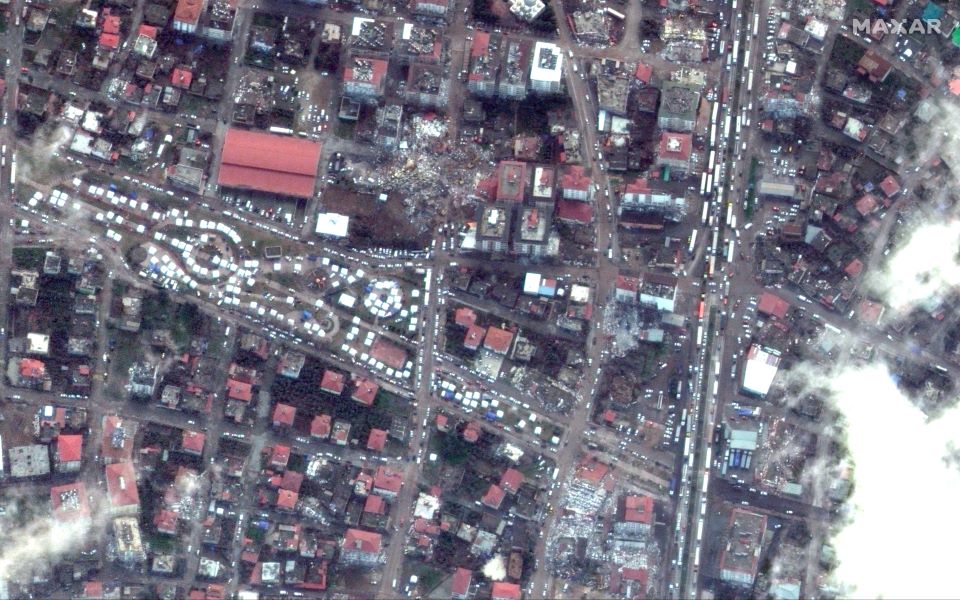
Turkey’s Disaster Management Agency said 11,342 buildings have collapsed, of which 5,775 have been confirmed, according to data available so far. Many of the tallest buildings in the area collapsed in Nurdai.
In some of the busiest areas of Noordaga, roads were blocked by ambulances and emergency services.
Over 8,000 people were reportedly excavated from the ruins, but it is estimated that thousands more remain trapped.
In some cases, for example, in the city of Islaye, located south of Nurdaya, also close to the epicenter of the earthquake, a large number of buildings were completely destroyed. Local authorities cut off natural gas supplies to prevent explosions, leaving thousands of homes without heat.
It is noted that tens of thousands of people were injured and left homeless at one moment, in the midst of bad weather and cold.
Source: Guardian
Source: Kathimerini
Anna White is a journalist at 247 News Reel, where she writes on world news and current events. She is known for her insightful analysis and compelling storytelling. Anna’s articles have been widely read and shared, earning her a reputation as a talented and respected journalist. She delivers in-depth and accurate understanding of the world’s most pressing issues.